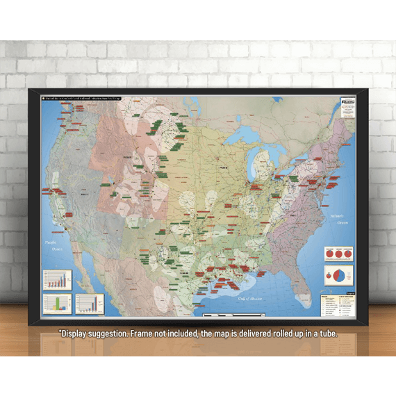
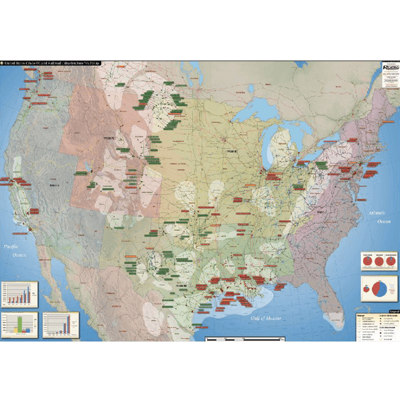
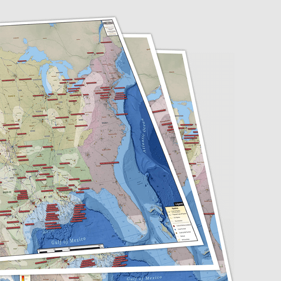
U.S. Crude by Rail Infrastructure

$ 329.00
SSL Secure Payments
100% Money back Guaranteed
Delivery 1-7 Days
Payment methods


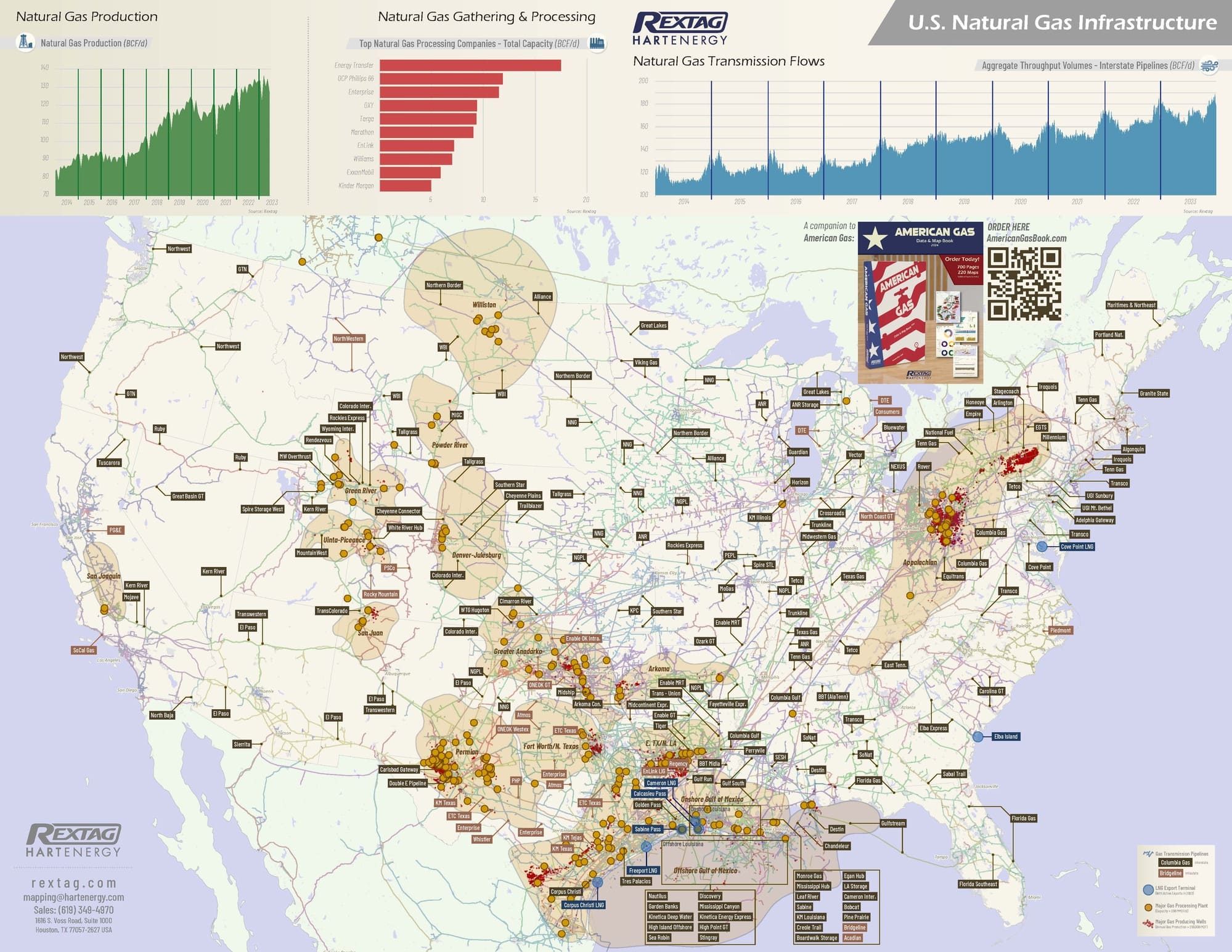
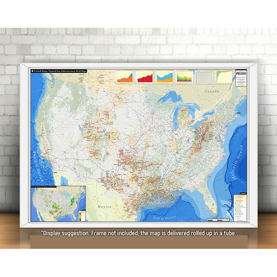
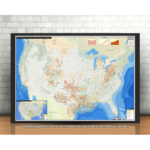
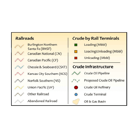
The U.S. Crude by Rail Infrastructure Wall Map is Hart Energy’s most recent addition to our family of beautiful and informative wall maps. This astounding map provides both comprehensive and simplified information on the extensive railroad, crude oil by-rail terminal, and crude oil pipeline network in the United States.
The U. S. Crude Oil and Railroad Infrastructure Wall Map contains the following features:
(42" x 60")
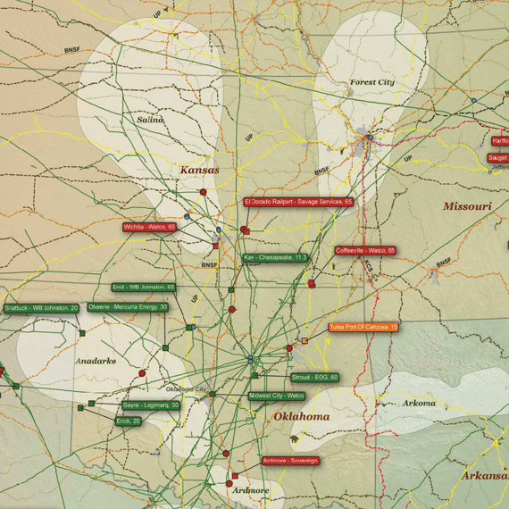
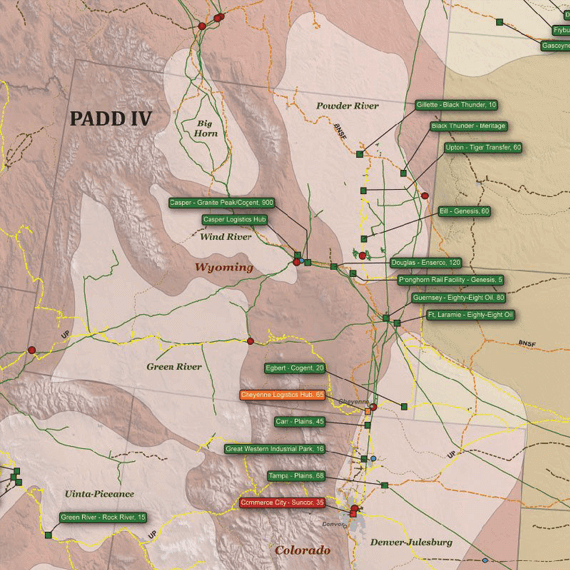
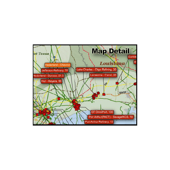
- Railroad Lines (labeled and color coded by operator)
- Crude by Rail Terminals (labeled with names and capacity, and color coded by type)
- Crude Refineries (labeled with name and capacity)
- Crude Terminals (non-rail terminals)
- Crude Oil Pipelines (labeled with operator names)
- Operator, Commodity, and Diameter Info Bubbles for Major Pipelines
- Oil & Gas Basins (labeled with names)
- Multiple informative charts related to the Crude by Rail market
Maps are printed on matte paper.

Featured products